ARAGONÉS PIRINEO SOBRARBE - Morillo de Tou
←
→
Transcripción del contenido de la página
Si su navegador no muestra la página correctamente, lea el contenido de la página a continuación

SOBRARBE-PYRÉNÉES · RANDOS ET BALADES
 SOBRARBE-PYRENEES · WALKS AND DAY TRIPS

   SOBRARBE
 PIRINEO
ARAGONÉS
 EXCURSIONES Y PASEOS
 RECOMENDADOS

EligE El rEcorrido quE sE
  adapta a tus posibilidades
  Infórmate antes de salir del perfil de la ruta, altura              INFÓRMATE del
  subida, distancia, etc. Lleva siempre un mapa.
                                                                      tiempo
                                                                      Los cambios bruscos del tiempo
                                               ConoCe                 en la montaña son frecuentes y se
                                                                      pueden dar tormentas, nieve, vien-
                                                  tus                 to, frío, granizo, los cuales pueden

                                                    LÍMITES
                                                                      hacer que la situación cambie.

                                        Mide tus fuerzas y tu
                                        capacidad. Nunca te
                                        sobrevalores                      No
                                                                          VAYAS
                                                                          SOLO
                                                                      Informa a algún familiar, amigo o
                                                                      alojamiento donde estás alojado de
                                                    CALZADO           dónde vas y cuándo piensas volver,
                                                    Ponte ropa        qué ruta vas a hacer, etc. No cam-

                                    10              y calzado
                                                    adecuado.
                                                                      bies de itinerario sobre la marcha.

   DECÁLOGO                         CONSEJOS
                                                                 POCA COMIDA Y
                   DEL EXCURSIONISTA                       muCha agua
                                                             Planifica bien la cantidad
                                                                 de comida y de agua

                                                             ,          TELÉFONO MÓVIL
                                     el botiquin                        con batería cargada
                                     debe formar parte de la            imprescindible.
                                     mochila. Una simple rozadura       En caso de accidente
                                     puede hacer más fatigosa la        podrás llamar al 112
Respeta                              ruta y amargarte la excursión.     siempre cuando haya cobertura 2G
el medio
                                                                        de cualquier compañía.

                                                       ADÁPTATE a las posibilidades del más débil.
Respetar las indicaciones y las
normas del espacio natural.
Tratar las basuras de forma                            Cada montañero es responsable de sí mismo
adecuada. No molestar a las                            y de sus compañeros, sé solidario.
especies ni alterar el entorno

                                                       112 TELÉFONO DE EMERGENCIA
¿CÓMO UTILIZAR ESTA GUÍA?
COMMENT UTILISER CETTE BROCHURE?
HOW TO USE THIS BROCHURE?
E  sta guía ha sido creada por
   la Asociación Empresarial
Turística de Sobrarbe como una        C   ette brochure a été créée
                                          par l’Association des En-        T  his brochure has been produ-
                                                                              ced by the Sobrarbe Business
herramienta orientativa para          trepreneurs du Sobrarbe pour         Association as an illustrative gui-
los visitantes. En ella encontra-     les nombreux visiteurs qui y         de for visitors. You can get to
rás paseos y excursiones, en su       viennent. Vous y trouverez des       know this beautiful area all the
mayoría sencillos, aunque no          balades et randos en général         better by doing these walks and
todos (ver icono), para conocer       faciles (même si toutes ne le        excursions, most of them easy,
mejor este precioso territorio.       sont pas, voir icône) pour vous      though some more challenging
Aún con todo, recomendamos            aider à mieux connaître ce ma-       (consult the icons key).
ampliar SIEMPRE la informa-           gnifique territoire. Malgré tout,    Whatever your plans, ALWAYS
ción aquí expuesta en las ofi-        nous vous recommendons de            supplement the information you
cinas de turismo (ver pág. 42).       TOUJOURS verifier les informa-       have here with further details
                                      tions ici données dans les offices   from the tourist offices (pag. 42).
                                      de tourisme locaux (pag. 42).

LEYENDA/LÉGENDE/LEGEND
  Los mapas no son a escala y son solo orientativos
  Les plans ne sont pas à échelle et sont simplement orientatifs
  The maps are not to scale and only approximate

       Carretera/Route/Road               Ermita/Chapelle/Chapel      Toda la comarca de Sobrarbe es un geo-
       Sendero/Sentier/Foot path          Cueva/Grotte/Cave           parque, por lo que todas las excursiones
       Ruta/Itinéraire/Route              Camping                     aquí descritas tienen interés geológico.
       Pozas/Bassins/Pools                Embalse/Barrage/Reservoir   Algunos de estos recorridos se encuen-
       Pueblo/Village/Village             Paisaje/Paysage/Views
                                                                      tran interpretados geológicamente al
       Casas/Maisons/Houses                                           formar parte de la Red de Geo Rutas del
                                          Puente/Pont/Bridge          Geoparque Mundial UNESCO de Sobrarbe
       Pueblo deshabitado
       Village abandonné                  Molino/Moulin/Mill          -Pirineos y puede descargarse la informa-
       Abandonned village                                             ción en www.geoparquepirineos.com.
       Castillo/Château/Castle            Barrera/Barrière/Barrier
                                                                      Para más información:*
       Geo Ruta/Geo Route/Geo Route      Refugio/Refuge/Refuge
                                                                      Toute la région du Sobrarbe est un
                                                                      géoparc, et toutes les randonnées ici
                                                                      décrites ont, par conséquent, un inté-
    Dificultad Difficulté Difficulty                                  rêt géologique. Pour plus d’informa-
    Desnivel Dénivelé Climb                                           tions sur le Géoparc Mondial Unesco
                                                                      de Sobrarbe-Pyrénées et toutes les
    Tiempo Durée Duration
                                                                      géo-balades à la géologie remarquable.*
    Punto de partida Point de départ Starting point
                                                                      The whole Sobrarbe region is a Geopark,
    Señalización Signalisation Sign-posting                           so all the excursions listed here have a
    Para familias Adapté aux familles Family friendly                 degree of geological interest.*
    Tener cuidado Faire attention Caution                             * Espacio del Geoparque
    No apto para familias Non recommandé aux familles                 Castillo de Aínsa. 974 500 614
    Not suitable for families                                         www.geoparquepirineos.com
                                                                                                             3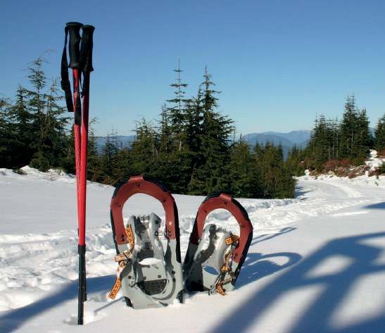
SOBRARBE
MAPA/CARTE/MAP
Tunel de
Bielsa a Francia
A-138
PARQUE NATURAL
SAN NICOLÁS POSETS-MALADETA
DE BUJARUELO PARQUE NACIONAL 22 26
14 15 DE ORDESA Y ESPIERBA
PARZÁN
MONTE PERDIDO 18
TORLA-ORDESA BIELSA SECTOR
a Biescas
N-260 13
16 BAL DE 23
BROTO TELLA
17
CHISTAU
FANLO 19 25 GISTAÍN
SARVISÉ HU-631
BUERBA
21 SECTOR PLAN
A-2609 24 SAN JUAN DE PLAN
ALTO CINCA
CA
BADAÍN 27
ÑÓ
20
ND
A-138 LAFORTUNADA
EA
SECTOR
ÑIS
ca
Cin
CLO
ALTO ARA BELSIERRE
Río
LASPUÑA
12 ESCALONA
N-260 FISCAL JAVIERRE
DE ARA
a Sabiñánigo
N-260 Río Ara
JÁNOVAS
SECTOR CENTRAL
LABUERDA
BOLTAÑA 8 EL PLANO
a Campo
9 N-260 EL PUEYO
DE ARAGUÁS
AÍNSA N-260
10 GERBE
CAMPODARVE
GUASO
11 7
SECTOR BIELLO MORILLO
SOBRARBE 1
DE TOU
SECTOR LA FUEVA
Emblase 6 TIERRANTONA
de Mediano
FOTO dE PORTAdA - PhOTO ARCUSA
COUVERTURE- COVER PICTURE
Ibón de Plan. Pedro Montaner© EL COSCOLLAR SAMITIER 4
FOTOS PáG 17
Centro de Vacaciones Morillo de Tou PARQUE NATURAL 5
FOTOS PáG 30-31 Emblase
DE LA SIERRA Y LIGÜERRE DE CINCA del Grado
Alfonso Ferrer Yus CAÑONES DE GUARA
EdITA / EdITION
Asociación Empresarial Turística ABIZANDA 2
de Sobrarbe LECINA BÁRCABO
C/ Pineta, 3. 22330 Aínsa a Barbastro
+ 34 974 51 00 16 3
info@pirineoturismo.com
dISEÑO / dESIGN
www.jaujaestudio.com
CONTENIdOS / CONTENUS / CONTENTS
4
ÍNDICE | INDEX
¿CÓMO UTILIZAR ESTA GUÍA? COMMENT UTILISER CETTE BROCHURE? HOW TO USE
THIS BROCHURE? ..................................................................................................................................... pág.3
RUTAS Y PASEOS RANDOS ET BALADES WALK AND DAY TRIPS
   SECTOR/SECTEUR/AREA BIELLO SOBRARBE
   1- Cueva del Anís/Grotte de l’Anis/ Anis cave ................................................................................ pág.7
   2- Abizanda .................................................................................................................................................... pág.8
   3- Lecina .......................................................................................................................................................... pág.9
       SECTOR/SECTEUR/AREA LA FUEVA
       4- Samitier ....................................................................................................................................................pág.10
       5- Entremón .................................................................................................................................................. pág.11
       6- Muro de Roda.........................................................................................................................................pág.12
       SECTOR/SECTEUR/AREA CENTRO
       7- Gerbe .........................................................................................................................................................pág.13
       8- Espelunga.................................................................................................................................................pág.14
       9- Confesionario .........................................................................................................................................pág.15
       10- Guaso......................................................................................................................................................pág.16
       11- Aínsa-Morillo .........................................................................................................................................pág.17
       SECTOR/SECTEUR/AREA RIBERA DEL ARA
       12- Fiscal-San Miguel................................................................................................................................pág.18
       13- Fragen-Oto ............................................................................................................................................pág.19
       14- Bujaruelo-Puente/Pont/Bridge Oncins ........................................................................................ pág.20
       15- Cascada/Cascade/Waterfalls Arripas Ordesa ......................................................................pág.21
       16- Pradera/Prairie de Ordesa por/par/by Turieto .......................................................................pág.22
       SECTOR/SECTEUR/AREA ALTO CINCA
       17- Ermitas/Chapelles/Chapels Tella..................................................................................................pág.23
       18- Bielsa-Parzán........................................................................................................................................pág.24
       19- Sestrales desde/depuis/from Plana Canal..............................................................................pág.25
       20- Fuentes Fornos ....................................................................................................................................pág.26
       21- Ruta del agua/Itinéraire de l’eau/Water route Añisclo.......................................................pág.27
       22- Llanos de Lalarri.................................................................................................................................pág.28
       SECTOR/SECTEUR/AREA BAL DE CHISTAU
       23- Senderos/Sentiers/Foot paths Cinqueta...................................................................................pág.29
       24- Plan-Gistaín-San Juan ....................................................................................................................pág.30
       25- Plan-Serveto.........................................................................................................................................pág.31
       26- Ruta de los refugios/Tour des refuges/Mountain refuge route.......................................pág.32
       27- Ibón/Lac/Lake de Plan ................................................................................................................... pág.33
MUSEOS MUSÉE MUSEUM . ..................................................................................................................... pág.34
NIEVE NEIGE SNOW.................................................................................................................................. pág.36
LISTADO DE ASOCIADOS LISTE DES ASSOCIÉS LIST OF ASSOCIATES ................................ pág.38
MÁS INFORMACIÓN TURÍSTICA PLUS D’INFOS MORE INFO ............................... ..........................pág.42
                                                                                                                                                                                  5
DesDe la asociación empresarial TurísTica De sobrarbe Te comenTamos:
l’associaTion Des enTrepreneurs Du sobrarbe vous faiT savoir :
a couple of Tips from The sobrarbe business anD Tourism associaTion:
en esta selección de los innume-
rables paseos que puedes dar               plusieurs de nos entreprises           in this section covering the nu-
por sobrarbe, varias de nuestras           membres ont une prédilection           merous walks you can take in so-
empresas asociadas tienen pre-             pour les randonnées ci-après et        brarbe, several of our associate
dilección por alguna de ellas y te         vous invitent à les découvrir.         businesses favour some of them
invitan a recorrerlas.                     pour plus de sécurité et de plaisir    and encourage you to try them.
para mayor seguridad y disfrute            dans vos sorties en montagne,          For the complete safety and enjoy-
en tus salidas al monte, te reco-          nous vous recommandons de faire        ment of your mountain walks, from
mendamos contratar a cualquiera            appel à nos bureaux de guides          sobrarbe business and Tourism
de nuestras empresas de guías              spécialisés dont vous trouverez        association we recommend that
especializados que encontrarás             les coordonnées à la pag. 40 de ce     you employ the services of any of
en la pág. 40 de esta guía.                guide. et souvenez-vous, laissez       our specialized guide businesses
y, recuerda, deja la montaña y los         la montagne et les rivières aussi      that you’ll find on pag. 40 of this
ríos tan limpios como te gustaría          propres que quand vous êtes arri-      guide. and remember, leave the
encontrarlos. la basura no vuelve          vés. les déchets ne se ramassent       mountains and rivers as clean
sola.                                      pas tout seuls.                        as you’d like to find them. litter
                                                                                  doesn’t pick itself up!

excursión rando walk                                 recomendado por recommandé par recommended by
nº 5 – congosto del entremón                         Ferretería s. pueyo Ferrer
nº 7 – sendero ornitológico y botánico de Gerbe      casa Gerbe
nº 9 – barranco del confesionario, un paraíso natural camping boltaña
nº 10 – descubriendo Guaso y sus barrios             estación de servicio cepsa de aínsa
nº 11 – de aínsa a morillo de Tou por cerro cotón    centro de Vacaciones morillo de Tou
nº 12 – Fiscal y la ermita de san miguel             Hostal río ara
nº 14 – puente de bujaruelo–puente de oncins         Hotel barceló monasterio de boltaña
nº 15 – cascada de arripas – ordesa                  camping aínsa
nº 17 – ruta de las ermitas de Tella                 caserío san marcial
nº 18 – bielsa-parzán por el pr-189                  restaurante bistró kanguro Truchero
nº 19 – sestrales desde plana canal                  Hotel casa de san marín
nº 21 – ruta del agua añisclo                        Hotel arnal
nº 22 – llanos de lalarri – pineta                   casas de Zapatierno
nº 27 – subida al ibón de plan                       Hotel mediodía

6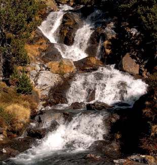
SECTOR BIELLO SOBRARBE
                                                                                                    PR

                                                                                                       Sarrastaño

                                                                                        STA. MARÍA
                                                                                        DE BUIL
                                                                 Cueva
                                                                 del Anís

                                                                                    SARRATILLO

    DE SANTA MARÍA DE BUIL A LA CUEVA DEL ANÍS
1   sanTa maría De buil – sarraTillo – GroTTe De l’anis
    sanTa maría De buil – sarraTillo – anís cave
    salimos de santa maría de buil,
    antigua capital del sobrarbe, que     on part de santa maría de buil,           you start from santa maría de buil,
    destaca por sus dos iglesias (una     ancienne capitale du sobrarbe, qui        sobrarbe’s old capital, notable for
    de ellas ya casi en ruinas). Toma-    se distingue par ses deux églises         its two churches (one of which is in
    mos el camino hacia sarratillo y,     (l’une d’elles pratiquement en            near ruin).Take the path towards
    llegados allí, seguimos la indica-    ruines). prendre le chemin direc-         sarratillo and, once there, follow
    ción para la cueva que sale de la     tion sarratillo et, une fois arrivés,     the signs for the cave from the
    casa rural casa ramiz. para ver       suivre le panneau qui indique la          “casa rural casa ramiz”. To see
    la cueva será necesario bajar y       grotte et qui se trouve à côté du         the cave you’ll have to go down
    subir por una cuerda atada a un       gîte casa ramiz. pour voir la grotte,     a short rope tied to a tree. in past
    árbol. en esta cueva, los lugareños   vous devrez descendre et remonter         times, local people would distil
    destilaban antaño sus licores, el     par une corde attachée à un arbre.        their alcoholic spirits in the cave,
    chorro de agua fría que caía de la    dans cette grotte, les habitants          using the cold water flow to cool
    cascada enfriaba el hilo del alam-    des alentours distillaient autrefois      their stills. This special place is
    bique. un lugar especial, cargado     leurs liqueurs, car l’eau fraîche de la   steeped in mystery.
    de misterio.                          cascade servait à refroidir le tuyau      suitable for families but the rope
    apto para familias pero la ba-        de l’alambic. il s’agit d’un lieu par-    descent should be supervised by
    jada a la cueva tiene que estar       ticulier et plein de mystère.             at least 2 adults.
    supervisada por al menos dos          attention à la descente par la corde!
    adultos.

          baja. facile. low
          50 - 100 m.
          1h50 (ida y vuelta) 1h50 (aller/retour) 1h50 (there and back).
          santa maría de buil. santa maría de buil. santa maría de buil.
          señalizada, accesible todo el año. indiqué, accessible toute l’année. Well signed, accessible all
          year round.
                                                                                                                      7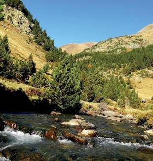
SECTOR BIELLO SOBRARBE
                                  Barranco

                          Atalaya
              Pozo
              Árabe
                          Plaza             Casa de
                                           los Títeres
                    Bar

    DESCUBRIENDO ABIZANDA…
2   À la DécouverTe D’abizanDa…
    DiscoverinG abizanDa…
    ruta circular que sale y vuelve a la
    plaza del pueblo. prever zapatillas     parcours circulaire, aller-retour       a circular route that starts and
    que se puedan mojar en caso de          sur la place du village. prévoir        finishes in the village square. Take
    hacer la ruta en primavera o tras       des chaussures qui peuvent se           waterproof footwear in springtime
    un día de lluvia.                       mouiller si vous faites cette balade    or if it’s raining.
    se coge el sendero detrás del bar       au printemps ou après un jour de        Take the footpath from behind
    restaurante dirección cueva de Vi-      pluie. prendre le sentier derrière le   the bar following signs to “la
    chicanera. pasaremos delante de         bar-restaurant direction la grotte      cueva de Vichicanera”. you’ll
    un pozo árabe restaurado y, tras un     de Vichicanera. Vous passerez           pass by a restored arabic well
    paseo de 15 minutos, llegaremos         devant un puits arabe restauré          and will reach the cave after a 15
    a la cueva. posteriormente, habrá       et en 15 minutes vous arriverez à       minute walk. next, you’ll cross
    que salvar un barranco que puede        la grotte. il faudra ensuite franchir   a small gulley whose stream mi-
    estar con agua especialmente en         un petit canyon où il peut y avoir      ght be running at times of heavy
    época de lluvia más intensa. pa-        de l’eau s’il a plu. après le canyon,   rainfall. once across the gulley
    sado el barranco, volveremos a          retour à la place du village après      you’ll come back to square cros-
    la plaza del pueblo pasando por         être passé par un pont romain           sing over a roman bridge and
    un puente romano y bordeando            et avoir longé la « maison des          walking alongside “la casa de
    la casa de los Títeres (¡no dejes       marionnettes », que nous vous           los Títeres” (don’t forget to visit
    de visitar el museo de los Títeres!)    recommandons de visiter.                the puppet museum!)

          baja. facile. low
          50 - 100 m.
          1h (ruta circular) 1h (circulaire) 1h (circular route)
          Detrás del bar, seguir indicación cueva. Derrière le bar, suivre le panneau “cueva”. behind the bar,
          follow the signs for “cueva”.
          señalizada, accesible todo el año según el nivel del agua. indiqué, accessible toute l’année en
          fonction du niveau de l’eau. Well signed, accessible all year round depending on water levels.
    8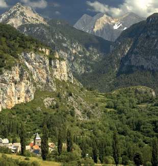
SECTOR BIELLO SOBRARBE
                                                                                                         BÁRCABO

                                                                      LECINA

                                                                                               A2205
                                                                              Encina
                                                                              Milenaria

                                                                             RÍO VERO           Parking Río Vero

                                                                  Geo ruta Gr 5
                                                                                               COLUNGO

    LOS ENCANTOS DE LECINA Y DEL RÍO VERO
3   le charme De lecina eT Du rio vero
    lecina anD rio vero’s charm
    lecina es todo un espectáculo. Tras
    dejar el coche en el aparcamiento        lecina est, en soi, une merveille.      lecina is simply spectacular. leave
    de la entrada del pueblo, acércate a     après vous être garé sur le parking     your car in the car park at the villa-
    la encina milenaria y admira su be-      à l’entrée du village, allez voir le    ge entrance and, go and visit the
    lleza. date una vuelta por el pueblo     chêne millénaire et admirez sa          famous thousand year old oak tree
    y disfruta de su tranquilidad y de sus   beauté (vous y serez en 5 min).         and marvel at its size and beauty
    bellos muretes de piedra. muchos         Vous pourrez faire de nombreuses        (you’ll get there in 5 minutes)
    son los paseos que puedes hacer          balades depuis lecina, voir des         Take a stroll around this peaceful
    desde lecina. podrás ver abrigos         abris rupestres et vous rafraîchir      village. There are several walks you
    rupestres y refrescarte en el cauce      dans le río Vero. nous vous pro-        can do from lecina. you can see rock
    del río Vero. nosotros te propone-       posons de reprendre la route et         caves and cool off in the river Vero.
    mos que cojas el coche y te vayas        de vous diriger au parking du rio       we suggest you take the car and go
    de lecina al parking del río Vero        Vero (route 2205, pk17, direction       from lecina to the river Vero car
    (carretera a2205, pk17 dirección         colungo). de là, descendez et vous      park (a2205 road, pk17 towards
    colungo). desde allí, baja al río y      arriverez à la station de jaujeage en   colungo). From there, you will reach
    llegarás a la estación de aforo en 5     5 mn (prévoir des chaussures qui        the gauging station in 5 minutes.
    minutos. (prever calzado que pueda       peuvent se mouiller). Traversez la      (be prepared to get your feet wet!).
    mojarse). cruza la pasarela y sigue      passerelle et suivez les indications    cross the walkway and follow the
    la señal hacia Fuente de lecina (5       vers la fontaine (fuente) de lecina     sign to Fuente de lecina (5 min).
    min). desde allí, vuelve al parking      (5 min). de là retournez au parking     From there return to the car park
    por el mismo camino.                     par le même chemin.                     along the same path.

          baja. facile. low
          135 m.
          visita de lecina: 45 min, bajada al río: 20 min (ida y vuelta) / visite de lecina: 45 min, descente à la
          rivière: 20min (aller/retour)/ lecina visit: 45 min. Walk down to the river: 20 min (round trip)
          aparcamiento del río vero, seguir pr hacia “fuente de lecina”. parking du rio vero, suivre le sentier
          direction “fuente de lecina”. rio vero car park, follow pr towards “fuente de lecina”.
          señalizada. indiqué. Well signed.
                                                                                                                         9
SECTOR LA FUEVA
                                       Embalse
            Geo ruta Gr 3             de Mediano

                             Castillos de
                                Samitier
    SAMITIER
                 Ermita de
                 San Emeterio
                 y San Caledonio
                                              Embalse
                                             de El Grado
    EN LAS ALTURAS DE SAMITIER: ERMITAS Y CASTILLO
4   Dans les hauTeurs De samiTier: chapelles eT chaTeau
    up above samiTier: chapels anD casTle
    ruta recomendable de corta dura-
    ción. la subida al conjunto religio-     balade agréable et courte. Très        a recommended route. an uphill
    so-militar de samitier, compuesto        peu d’ombre. paysage sauvage.          walk to the castle and chapel above
    por dos ermitas (una un poco antes       on peut rentrer à l’intérieur de       samitier takes you to an exposed
    de llegar a la cima) y un castillo, es   l’ermitage. depuis la piste, on a      and wild landscape. you can get into
    solanera y agreste. se puede acce-       une belle vue panoramique des          the chapel and through to the castle
    der al interior de la ermita abriendo    pyrénées et du sobrarbe. on peut       on its far side. The route winds its
    los pestiños. la ruta consiste en        voir les barrages et l’entremón de-    way up a well marked track. all the
    la ascensión a una colina por una        puis les hauteurs, tout en profitant   way up you’ll enjoy an ever impro-
    pista de tierra bien visible. desde      d’une tranquillité et d’un silence     ving view of the pyrenees and the
    allí, se tiene una gran panorámica       incomparables.                         sobrarbe. From the top the view
    del pirineo y el sobrarbe. se divisan                                           is unbeatable; from this peaceful
    los embalses y el estrecho del en-                                              viewpoint, to the north and south,
    tremón desde lo alto, y se disfruta                                             you’ll see the 2 reservoirs stretching
    de tranquilidad y silencio.                                                     away from the entremon below.
                                             Souvenez-vous!:
    Recuerda:                                “ respectez le patrimoine qui se
    “ respeta el patrimonio que en-          trouve autour de vous. laissez les     Remember:
    cuentras. deja puertas y ventanas        portes et fenêtres fermées quand       “respect these heritage buildings.
    cerradas cuando terminas tu visita,      vous avez fini votre visite, pour le   please close doors and windows
    por el bien común”.                      bien de tous”.                         after your visit”.

          baja-media. facile-moyen. low-medium
          230 m.
          2h (ida y vuelta) 2h (aller/retour) 2h (there and back).
          camino desde el pueblo de samitier. chemin depuis le village de samitier. footpath from the
          village of samitier.
          señalizada. accesible todo el año, excepto con nieve. balisé. accessible toute l’année sauf en cas
          de neige. Well signed. access all year, except with snow.
    10
Embalse de
Mediano
Presa
Recomendada por Torre de
Mediano de Mediano
FERRETERÍA S. PUEYO FERRER
www.spueyoferrer.com SECTOR LA
MEDIANO
Central
Hidroeléctrica
de Mediano
FUEVA
RÍO CINCA
Geo ruta Gr 4
Camino
del Entremón
Castillos de
Samitier
Grapas
SAMITIER Paso aéreo
Ermita de
San Emeterio
y San Caledonio
Puente del
Entremón
CONGOSTO DEL ENTREMÓN
5 GorGes De l’enTremon
The enTremón canyon
LIGÜERRE
P
Embalse
de Grado
DE CINCA
el entremón es el espectacular des-
filadero que une los embalses de l’entremon est le nom donné aux The entremón is a spectacular river
mediano y de el Grado. gorges spectaculaires qui unissent canyon linking the mediano and
se trata de un paisaje de gran be- les barrages de mediano et el Gra- el Grado reservoirs. This footpath
lleza pero la senda discurre por las do. le paysage qu’elles dessinent climbs up into the canyon through
alturas del desfiladero y el camino est d’une beauté époustouflante breathe-taking scenery, but the
es estrecho, por lo que no es reco- mais le chemin, étroit, passe par path is at times narrow with sheer
mendable para personas que su- les hauteurs des gorges, ce n’est drops to the river so it is not recom-
fran vértigo y para niños pequeños. donc pas une balade à faire si l’on mended for people with vertigo or
el sendero une los pueblos de li- souffre de vertiges ou en compagnie small children. The path links the
güerre de cinca (¡no dejes de visi- de jeunes enfants. le sentier relie villages of ligüerre de cinca (well
tarlo si tienes tiempo!) y de media- les villages de ligüerre de cinca (à worth a visit if you have time!) and
no. al finalizar la ruta, tendremos visiter si vous avez le temps) et de mediano. at the end of the route,
que subir por la presa y podremos mediano. a la fin de la balade, il you’ll go up onto the dam where
observar la torre de mediano bajo vous faudra arriver tout en haut du you’ll see the church tower of me-
las aguas del embalse del mismo barrage, où vous pourrez observer diano rising out of the reservoir.
nombre. una imagen estremecedo- le clocher de l’église de mediano it’s a heart–rending reminder of the
ra que nos recuerda la dura realidad sous l’eau du barrage qui porte harsh reality of reservoir building in
de la construcción de los pantanos son nom. une image poignante. this part of the pyrenees.
en esta parte del pirineo. la vuelta on reviendra au point de départ To get back you will retrace your
discurrirá por el mismo sendero. par le même chemin. steps along the same path.
baja. Tramos con sirgas y grapas. facile. sur la fin, tronçon avec cordes et échelles.
low. sections with cables and hand rails.
200 m.
2h (ida y vuelta) 2h (aller/retour) 2h (there and back).
puente tras ligüerre de cinca dirección palo. pont après ligüerre de cinca direction palo. bridge
past liguerre de cinca direction palo.
señalizada. indiqué. Well signed.
11SECTOR LA FUEVA
MURO DE RODA
HU-V-6442
LA CORONA
TIERRANTONA
MURO DE RODA, UN MIRADOR EXCEPCIONAL
6 muro De roDa, un miraDor excepTionnel
muro De roDa, an excepcional panoramic vieW poinT
muro de roda es una antigua for-
tificación militar, declarada monu- muro de roda est un ancien bâti- muro de roda is an ancient military
mento histórico-artístico en 1979. ment militaire, déclaré monument fort that was declared an histo-
se puede subir andando desde la historico-artistique en 1979. on ric-artistic monument in 1979. you
localidad de Tierrantona, pero tam- peut y monter à pied depuis le vil- can walk up to it from Tierrantona,
bién podemos subir en coche hasta lage de Tierrantona, mais on peut but there is also road access all the
el mismo conjunto (carretera asfal- aussi y monter en voiture (atten- way up (a tarmac road that turns
tada que se convierte luego en pista. tion: route goudronnée qui finit en into a track suitable for normal
accesible a turismos pero siempre piste. Faire attention. la meilleure vehicles driving cautiously. best
con cuidado. la mejor opción es solution est de monter en 4x4). là, in a 4x4). once there, you can vi-
subir en 4x4). desde allí, podremos vous pourrez visiter ce qui reste sit the remains of the religious/
visitar lo que queda del conjunto de la forteresse et de la chapelle, military site and its church, and
religioso militar y de la ermita y ten- et vous aurez une vue magnifique enjoy impressive views of the la
dremos unas vistas impresionantes sur la vallée de la Fueva d’un côté Fueva valley to the east and the
sobre el valle de la Fueva por un et le barrage de mediano de l’autre. mediano reservoir to the west. if
lado y el pantano de mediano por el si vous voulez rallonger la balade, you have the time and energy, you
otro. si vamos con tiempo y ganas, vous pouvez descendre jusqu’au can walk down to the abandoned
podremos bajar hasta el pueblo village abandonné de la corona et village of la corona and return by
deshabitado de la corona y volver revenir par le même chemin. the same route.
por el mismo camino.
baja pero extremar la precaución si se sube con coche. facile mais faire très attention
si vous montez en voiture. low, but be very careful if you go up by car.
490 m (se pueden hacer en coche) 490 m (qui peuvent se faire en voiture) 490 m (possible by car).
muro de roda: 1/2 h. a la corona: entre 1h o 1h 30min. muro de roda: 1/2h. À la corona: 1h -1h30.
muro de roda 1/2 h. To la corona: 1h o 1h 30min.
se puede llegar en coche hasta muro de roda. seguir pista y Gr1 hacia Griébal. on peut arriver en
voiture jusqu’à muro de roda. suivre le Gr1 direction Griebal. Get to muro de roda by car and follow
signs along the Gr1 to Griebal.
señalizada, mejor 4x4. indiqué, mieux en 4x4. Well signed, better 4x4.
12Recomendada por
CASA GERBE GR-19
www.casagerbe.com SECTOR Avistamiento
CENTRAL de rapaces Caseta de
observación
GERBE
Punta
de San
Pedro
SENDERO ORNITOLÓGICO Y BOTÁNICO DE GERBE
7 senTier orniTholoGique eT boTanique De Gerbe
Gerbe’s orniTholoGical anD boTanical fooTpaTh
esta ruta, iniciativa de un empren-
dedor local y apoyada por la red de cette balade, à l’ initiative d’un en- discover the village of Gerbe and
emprendimiento rural, nos permi- trepreneur local, nous permettra the area’s bird life along this path
tirá descubrir el pueblo de Gerbe de découvrir le village de Gerbe which was the idea of a local en-
y las aves que habitan por esta et les oiseaux qui vivent dans ce trepreneur. The walk starts at the
zona. la ruta se inicia en el cartel secteur. la balade commence au information panel at casa Gerbe
informativo que hay en casa Gerbe, panneau d’information de casa and the route takes you down an
nos lleva por un antiguo sendero Gerbe et un sentier nous mène à old path to san pedro’s point from
a la llamada punta de san pedro. la pointe de san pedro. revenir where you can enjoy views over
Volvemos por el mismo camino, par le même chemin, passer par the whole reservoir. you’ll come
pasamos por el interior del pueblo l’intérieur du village et remonter par back up on the same path, going
y ascendemos por la pista hasta la piste jusqu’au quartier de “cabo through the village, to then go up
el barrio de “cabo lugar”. desde lugar”. de là, continuer par la route the track to “cabo lugar”. From
allí, seguir por la antigua carrete- goudronnée pour arriver jusqu’au there, follow the old tarmac road
ra asfaltada para llegar hasta el mirador de la rivière lanata. conti- to get to the river lanata view
mirador del río lanata, continuar nuer sur l’ancienne nationale pour point and continue along the old
por la antigua nacional y volver a revenir sur le village de Gerbe, pour main road which takes you back
entrar a Gerbe para llegar al inicio. arriver au point de départ. il est into Gerbe to your starting point.
posibilidad de entrar a la caseta de possible d’entrer dans l’abri d’ob- you can stop off at the bird ob-
observación de aves (Hide), infor- servation des oiseaux . information servation hide, information and
mación y reservas en casa Gerbe. et réservations à casa Gerbe. reservations at casa Gerbe.
baja. facile. low
50 m.
+/- 1h30, más observación aves +/- 1h30, plus observation oiseaux. +/- 1h30, plus bird watching time.
iniciar en casa Gerbe. commencer le parcours à casa Gerbe. start at casa Gerbe
señalizada. balisée. Well signed.
13SECTOR CENTRAL Ermita de
la Espelunga
Virgen del Pilar Piedra de
San Victorián
PR-HU 43
San Antón
PR-HU 139
MONASTERIO
SAN VICTORIÁN
Geo ruta Gr 15
PR-HU 43
ERMITA RUPESTRE DE LA ESPELUNGA
8 san vicTorian eT chapelle De la espelunGa
san vicTorian & chapel of espelunGa
el primer tramo de la ruta transcurre
por la ladera rocosa de la montaña la première partie de la balade The first part of this route runs
en la que es imprescindible tener passe par le flanc rocheux de la along the rocky side of the moun-
mucho cuidado por el abismo que montagne (faire très attention tain where it’s important to be
se abre hacia la derecha. a los 15 au précipice qui s’ouvre vers la careful of the steep drop down to
minutos de camino, se encuentra droite). au bout de 15 minutes, the right. about 15 minutes into the
en un pequeño prado la ermita de vous passerez devant la chapelle walk you’ll come into a meadow
san antonio. la senda continúa de san antonio, dans un champ. le where you’ll find the san antonio
hacia un bosque y está indicada sentier continue vers la forêt et est chapel. The path continues through
por las pinturas blancas y amarillas balisé avec les marques blanches the wood and is marked out by the
que indican el pr. el final de la ruta et jaunes qui indiquent le pr. le white and yellow stripes of the pr.
asciende bastante, tomárselo con sentier monte assez sur la fin. The end of this route climbs quite a
calma y cuidado. la recompensa monter calmement et en faisant lot, take your time and tread carefu-
a nuestro esfuerzo: una preciosa attention. la récompense à nos lly. There’s a reward at the end of it
ermita y unas vistas espectaculares. efforts : une chapelle magnifique for your efforts though! : a beautiful
et une vue à couper le souffle. hermitage and spectacular views.
Recuerda: Souvenez-vous!: Remember:
“en el monte, vigila dónde pones los “attention où vous mettez les pieds “in the mountains, tread carefully
pies y agarra siempre a los niños en et tenez les enfants par la main dans and hold onto children in steep or
los tramos expuestos”. les tronçons à flanc de ravin”. sheer stretches”.
media. moyenne. medium
200 m
2h (ida y vuelta) 2h (aller/retour) 2h (there and back)
monasterio de san victorián. monastère de san victorian. monastery of san victorian
señalizada. accesible todo el año,excepto con nieve. balisé. accessible toute l’année, sauf en cas
de neige. Well signed. access all year, except with snow.
14Recomendada por
CAMPING BOLTAÑA
www.campingboltana.com SECTOR CENTRAL
SAN MARTÍN P
ste
S ie
o.
POZAS
Bc
SAN VELIÁN
El Confesionario
“Coño del mundo”
MORCAT
LUPARUELO
BARRANCO DEL CONFESIONARIO, UN PARAÍSO NATURAL
9 canyon Du confesionario, un paraDis naTurel
Gulley of confesionario, a naTural paraDise
ruta en la que el agua es la prota-
gonista con preciosas pozas y una balade qui vous permettra de décou- water is the star of this route with
sorpresa final: la cascada del con- vrir un canyon avec de magnifiques its stunning pools and there’s an
fesionario, también conocida como bassins et une surprise finale: la cas- absolute treat at the end of it :
coñoelmundo. esta excursión pue- cade du confesionario, aussi connue The confesionario waterfall, also
de realizarse como una ruta de ida y comme coñoelmundo. cette ran- known as the coñoelmundo.
vuelta remontando el barranco a pie donnée peut se faire en remontant This route can be done as a return
(prever entonces calzado de agua), le canyon (prévoir des chaussures trip on foot along the same gulley
o utilizando la senda que discurre qui peuvent se mouiller) ou en em- (water shoes advised), or using the
por la parte alta del barranco. para pruntant le chemin qui passe par le path that runs along the upper part
disfrutar de un baño en esas pozas, haut du canyon. pour vous baigner, of the gulley. The best time to enjoy
la mejor época es mayo-junio. la meilleure époque est mai-juin. a swim in these pools is may-June.
desde el aparcamiento, en 10 min y depuis le parking, en 10 mn et après leaving from the car park, the first
tras cruzar el barranco, llegaremos avoir traversé la rivière, on arrive aux pools can be reached in 10 minu-
a las primeras pozas. Tras 150 m por premiers bassins. après 150 m, par tes by crossing the gulley. 150 m
el sendero desde la primera poza le sentier depuis le premier bassin, along the path from the first pool
accedemos de nuevo al río. nos on arrive de nouveau à la rivière. you’ll join the river again. you’ll find
encontraremos con dos señales Vous tomberez sur deux panneaux, two signs about 20m apart giving
separadas por unos 20m para llegar séparés par 20m environ, qui vous directions to reach the waterfall
a la cascada por el barranco o por permettront d’arriver à la cascade by the ravine or by the footpath.
el sendero. par le canyon ou le sentier.
media, más desnivel si cogemos el sendero. moyenne, plus de dénivelé si on prend le
sentier. medium, more of a climb if you take the foot path.
300 m si vamos por sendero. 300 m si on prend le sentier. 300 m if you take the foot path
2h15 (ida y vuelta) 2h15 (aller/retour) 2h15 (there and back).
parking pozas de san martín. parking bassins de san martín. car park pools of san martin
señalizada, accesible todo el año. mejor época primavera. indiqué, accessible toute l’année. la
meilleure époque est le printemps. Well signed, accessible all year round. best time to go is spring.
15Recomendada por
ESTACIÓN SERVICIO CEPSA AÍNSA
SECTOR CENTRAL www.gasolineraainsa.com
AÍNSA
Barrio O Grao
Barrios
Sta Quitera
O Puyal
0
N26
05
P
A22
BOLTAÑA Barrios Arrabal
y Besgregui
DESCUBRIENDO GUASO Y SUS BARRIOS
10 aDiscover
la DécouverTe De Guaso eT De ses quarTiers
Guaso anD iTs surrounDinGs
Guaso es un bonito pueblo, muy
cerca de aínsa, que bien se merece Guaso est un joli village, tout près Guaso is a pretty village close to
una visita. aparcar en la entrada d’ainsa, qui mérite bien un petit ainsa, and it’s well worth a visit.
del pueblo y subir por la calle détour. se garer à l’entrée du vil- park at the entrance of the village
principal unos 30 m hasta llegar lage et remonter la rue principale and go up the main street for about
a la señal de pr 186 barrio del environ 30 m jusqu’à arriver à un 30 m until you reach the sign for pr
Tozal. pasar por el mirador de la panneau pr 186 barrio del Tozal. 186 barrio del Tozal. walk on past
cruceta y seguir las señales hacia passer à côté du mirador de la the “cruceta” viewpoint and fo-
la torre y su esconjuradero (tem- cruceta et suivre les panneaux llow the signs to the tower and the
plete de cuatro arcos). disfrutar jusqu’à l’église et son esconju- “esconjuradero” (a low 4 arched
del mirador geológico a la dere- radero (petit temple ouvert aux 4 monument). it’s worth taking in the
cha. bajar por la carretera para vents). profiter du mirador géolo- geological view point on the right.
ver el pueblo. llegados al coche, gique situé à droite. redescendre Go back down through the village
podemos andar (con mucho cui- par la route vers le village. Vous on the road. you can walk carefully
dado) por la carretera principal pourrez ensuite vous rendre à pied along the main road and visit nei-
para visitar más barrios, como (en faisant très attention) par la ghborhoods such as l’arrabal or
l’arrabal o bestregui. en el barrio a2205 aux quartiers de l’arrabal bestregui. in the neighbourhood
o Grao, cercano a aínsa, está la ou de bestregui. dans le quartier of el Grado which lies closest to
impresionante casa broto (a la o Grao, près d’aínsa, vous pourrez aínsa, you’ll find casa broto, an
izquierda), que llegó a ser hasta voir casa broto (à gauche) qui, impressive house that long ago
cárcel en tiempos antiguos. jadis servit de prison. was used as a jail.
baja. facile. low
100 m
1h-1h30
Dejar el coche en la entrada del pueblo y subir la calle principal. se garer sur le parking à l’entrée du
village et monter la rue principale. leave your car at the village entrance and go up the main street.
señalizada. marcada, accesible todo el año. indiqué, accessible toute l’année. notes: Well signed,
accessible all year round.
16Recomendada por
C. VACACIONES MORILLO DE TOU
www.morillodetou.com SECTOR CENTRAL
Ermita de la Virgen
de Los Palacios
Cerro Cotón
Torre
de Tou
BRUELLO
MORILLO
DE TOU
DE AÍNSA A MORILLO DE TOU POR CERRO COTÓN
11 D’ainsa À morillo De Tou par cerro coTón
from ainsa To morillo De Tou via cerro coTón
desde el puente del río ara di-
rección morillo de Tou, andamos prendre le chemin (attention ça Following directions to morillo de
unos 10 minutos y llegaremos al monte) derrière l’hôtel meson de Tou, a 10 min walk from the bridge
desvío de la ermita de la Virgen l’aínsa et, en 10 min, vous arrive- over the river ara will get you to
de los palacios. abandonamos el rez à la bifurcation de la chapelle the turn-off to the Virgen de los
pr Hu 70 para seguir la indicación Virgen de los palacios. là, ne plus palacios chapel. leave the pr Hu
“morillo por sendero” y tras un suivre le pr Hu 70 mais l’indication 70 and follow signs to “morillo por
corto ascenso llegamos al cerro “morillo par sentier” et après une sendero” and after a short climb
de cotón (Torre de Tou). Vistas petite montée, on arrive à cerro de you’ll arrive at the cerro de cotón
impresionantes. desde allí, vuelta cotón (Tour de Tou). de là, retour- (Tower of Tou). From there, you
a aínsa por un sendero de pinos ner à aínsa par un sentier de pins return to aínsa on a path through
(también se puede alargar la ruta (on peut aussi rallonger un peu et pinewoods (you can also extend the
hasta morillo de Tou); subir a la arriver à morillo de Tou); monter à walk to morillo de Tou); go up to
cruceta de bruello hasta llegar al la cruceta de bruello pour arriver bruello until you get to the cerro de
cerro de partara y bajar hasta el au cerro de partara et descendre partara and then head back down
punto de partida en aínsa. jusqu’au point de départ à aínsa. to your starting point in aínsa.
Recuerda: Souvenez-vous!: Remember:
“Ten siempre a mano una gorra y cre- “ayez toujours à portée de main une “always take a hat and sun cream
ma solar. protege bien a los niños”. casquette et de la crème solaire. with you. keep children well pro-
protégez bien les enfants”. tected ” .
media. moyenne. medium
250 m.
2h30-3h (ida y vuelta) 2h30-3h (aller/retour) 2h30-3h (there and back)
pista detrás de hotel mesón de l´ainsa. piste derrière l’hôtel meson de l’ainsa. Track behind the
mesón de l´ainsa hotel
señalizada, accesible todo el año. indiqué, accessible toute l’année. Well signed, accessible all
year round.
17Recomendada por
HOSTAL RÍO ARA
SECTOR RIBERA DEL ARA www.hostalrioara.com
Río Ara Ermita de
San Miguel
N26
0
FISCAL
Fuente de
Moliniella Río Ara
FISCAL Y LA ERMITA DE SAN MIGUEL
12 fiscal eT la chapelle De san miGuel
fiscal anD The san miGuel chapel
saldremos del centro del pueblo
donde veremos el arco de la iglesia partir du centre du village à côté de it begins in the middle of the village
de Jánovas al lado del ayuntamien- la mairie. se diriger vers le pont en where you’ll see the arch from the
to. ir hacia el puente de piedra sobre pierre sur la rivière ara et, avant de church in Janovas next to the town
el río ara y, antes de cruzar, visitar el traverser, visiter le fouloir (batán) hall. Head towards the stone bridge
batán de lacort (máquina hidráulica de lacort (machine à mécanisme over the river ara and just before it,
para golpear tejidos). es el batán hydraulique servant à frapper les have a look at the ancient “batan de
mejor conservado de aragón. pa- tissus lors de leur confection). lacort” (a hydraulic textile beating
sado el puente, ir a la derecha y, après le pont, aller à droite et après contraption). Go over the bridge,
tras unos 30 m, del otro lado de la environ 30 m, de l’autre côté de la turn right and after 30 m on the
carretera nacional, se ve el sendero route, vous verrez le sentier qui other side of the main road, you’ll
que lleva hasta la ermita. subiremos va jusqu’à la chapelle. monter et see the foot path that leads to the
y bajaremos por el mismo sitio (ojo, descendre par le même sentier (at- chapel. you will take the same route
subida pronunciada) pudiendo ha- tention, pente raide). Vous pourrez going up as you will coming down
cer este paseo en 1h15 ida y vuelta faire cette balade aller-retour en (careful, steep climb).
más o menos. la ermita se encuen- 1h15 environ. la chapelle se trouve you’ll be able to do this round trip
tra desgraciadamente en bastante malheureusement en assez mau- walk in 1h15 more or less. unfor-
mal estado de conservación, pero vais état, mais la vue sur Fiscal, la tunately the hermitage is in a bad
las vistas sobre Fiscal, el río ara y rivière ara et peña canciás valent state of repair, but the views across
peña canciás merecen la pena. le détour. to Fiscal, the river ara and the peña
canciás are worthwhile.
media. moyenne. medium
315m.
1h-1h30 (ida y vuelta) 1h-1h30 (aller/retour) 1h-1h30 (there and back)
inicio: centro del pueblo o puente de piedra que cruza el río cinca. centre du village ou pont en pierre
qui traverse la rivière cinca. village centre or stone bridge over the river ara
marcada, accesible todo el año. indiqué, accessible toute l’année. Well signed, accessible all year
round.
18SECTOR RIBERA DEL ARA
SAN MIGUEL
Río Ara
FRAGEN
LA ASUNCIÓN
Bco Cascada
. So
rros
al
Sorrosal
BROTO
SAN SEBASTIAN
Geo ruta Gr 8 OTO
DE FRAGEN A OTO
13 DefromfraGen a oTo
fraGen To oTo
saldremos del pueblo de Fragen,
hacia el pueyo (pr-Hu127), que es on partira du village de Fragen, leaving the village of Fragen
una pradera muy agradable para direction le lieu-dit el pueyo (pr- and heading to el pueyo on the
que los niños corran sin miedo. Hu127), une prairie très agréable (pr-Hu127),you’ll pass through a
cuando lleguemos al final del pue- pour que les enfants puissent nice meadow where children can
yo tendremos unas espectaculares s’amuser. play safely.
vistas a la cascada de sorrosal (allí au bout du pueyo, on a une vue when you get to el pueyo you’ll
es donde termina la vía ferrata que sensationnelle sur la cascade de enjoy spectacular views over the
pasa por la cascada). sorrosal (c’est là où finit la via fer- sorrosal waterfalls (this is where
para bajar a oto, salvaremos 150m rata qui passe sous la cascade). the via ferrata that goes through
de desnivel (y por consiguiente los pour descendre à oto, il y a 150m the waterfall ends).To get to oto
mismos 150 metros cuesta arriba de dénivelé (et par conséquent, you’ll go down 150 m in altitude
para volver a Fragen, ya que la il faudra ensuite remonter 150 m (which you’ll have to go up again to
vuelta se hará por el mismo sitio). pour retourner à Fragen, car le re- get back to Fragen along the same
podemos alargar la excursión tour se fait par le même chemin). route). you can extend the route
hasta broto y ver la cascada de on peut rallonger la balade jusqu’à up to broto or just have a good
sorrosal, esta vez, desde abajo. broto et voir la cascade de sorrosal look at the sorrosal waterfalls in
cette fois, depuis en bas. oto, from down below.
baja pero hay una subida muy pendiente entre oto y fragen. facile mais montée très
prononcée entre oto et fragen. low but very steep drop/climb between oto and fragen.
150 m
2h (ida y vuelta) 2h (aller/retour) 2h (there and back)
pueblo de fragen o, si se prefiere empezar por la subida, inicio en oto. village de fragen ou, selon préfé-
rence, commencer la montée par oto. village of fragen or if you prefer starting with the climb, from oto
marcada, accesible todo el año pero extremar la precaución en invierno. indiquée, accesible toute l’année mais
faire très attention en hiver. Well signed, accessible all year round but exercise extreme caution in winter.
19Recomendada por
BARCELÓ MONASTERIO DE BOLTAÑA
SECTOR RIBERA DEL ARA www.barcelo.com
Garganta
del Ara Barranco de
Puente de Lapazosa
Oncins
Puente de Bujaruelo
BUJARUELO
PUENTE DE BUJARUELO - PUENTE DE ONCINS
14 ponT De bujaruelo - ponT D’oncins
bujaruelo briDGe – oncins briDGe
bujaruelo ofrece una gran canti-
dad de preciosas rutas de sende- la vallée de bujaruelo vous donne- bujaruelo offers a great number
rismo para todos los niveles. muy ra un large éventail de randonnées of stunning routes and foot paths
cerca del pn de ordesa, podréis pour tous les niveaux. situé juste à for all levels. it’s very close to the
acceder a ese valle en coche sin côté du pn d’ordesa, vous pourrez ordesa national park and can be
restricciones. se puede llegar accéder à cette vallée en voiture easily reached by car in all sea-
hasta san nicolás de bujaruelo sans restrictions. Vous pouvez ar- sons. you can easily drive up to
(refugio y zona de acampada) con river jusqu’à san nicolás de buja- san nicolás de bujaruelo (refuge
coche particular, por una pista en ruelo (refuge et aire de camping) and campsite) along a well main-
buen estado y muy transitada. en voiture par une piste en bon tained and frequently used track.
desde allí cruzaremos el puente état et où passent beaucoup de From there continue on foot over
románico de piedra y remonta- véhicules. de là, traverser le pont the romanesque stone bridge and
remos el río ara por un sendero en pierre et remonter la rivière ara follow the river ara upstream on
a la izquierda del río hasta llegar par le sentier à gauche du pont the right hand path until you get
al puente de oncins (30 minutos) jusqu’à arriver au pont d’oncins the oncins bridge (30 minutes).
la vuelta se hará por el mismo sitio (30 min). on pourra revenir par come back down on the other
o, si se prefiere, también se puede le même chemin ou emprunter la side on a circular route.
volver a san nicolás por la pista piste forestale qui vous ramènera
forestal. à san nicolás, après avoir traversé
le pont d’oncins.
baja. facile. low
20 m
1h (ida y vuelta) 1h (aller-retour) 1h (there and back)
san nicolás de bujaruelo. san nicolas de bujaruelo. san nicolas de bujaruelo
marcada, accesible desde el deshielo. indiqué, accessible à partir du dégel. Well signed, accessi-
ble without snow.
20Recomendada por
CAMPING AÍNSA
www.campingainsa.com SECTOR RIBERA DEL ARA
Geo ruta pn1
Puente de
Arripas
PRADERA Cascada
DE ORDESA de Arripas
zas
Río Ara
Río Arazas Puente de
Cotatuero
CASCADA DE ARRIPAS - ORDESA
15 cascaDa De arripas - orDesa
arripas WaTerfalls - orDesa
ruta recomendable de corta du-
ración para hacer en familia aden- balade agréable et courte, à a short circular route reccomen-
trándonos en el imponente Valle faire en famille, pour pénétrer ded for all the family entering the
de ordesa. Tomamos el camino dans l’imposante vallée d’orde- magnificent ordesa Valley.
de soaso hasta el mirador de la sa. prendre le sentier de soaso Take the soaso footpath up to the
cascada de arripas. atravesamos jusqu’au mirador de la cascade view point at the arripas water-
el puente sobre el río arazas para d’arripas. Traverser le pont sur la falls. cross the bridge over the
llegar a la cascada de arripas. el rivière arazas pour arriver jusqu’à river arazas and continue to the
camino de vuelta discurre por la la cascade. pour revenir, passer waterfalls. The return path runs
margen izquierda por la senda par la rive gauche vers la prairie along the left hand side on the
de los cazadores en dirección a d’ordesa. “senda de los cazadores” hea-
la pradera de ordesa. ding back towards the ordesa
meadows.
Recuerda: Souvenez-vous!: Remember:
“respeta las barreras. no te acer- “souvenez-vous!respectezlesbarrières. “respect gates and barriers. don’t
ques a las cascadas. el riesgo de nevousapprochezpasdescascades.le get too close to waterfalls. There
resbalar y caerse es real y puede ser risque de glisser et de tomber est réel. is a real risk of slipping and falling
letal. ninguna foto vale una vida”. aucune photo ne vaut une vie ”. which can be lethal. no photo is
worth dieing for”.
baja. facile. low
100 m
2h (ida y vuelta) 2h (aller-retour) 2h (there and back)
parking de la pradera de ordesa. parking de la prairie d’ordesa. ordesa meadows car park
señalizada. accesible todo el año, excepto con nieve. balisé. accessible toute l’année, sauf en cas
de neige. Well signed. access all year, except with snow.
21También puede leer